
For a long time, I have known that the area around Saint-Chinian is particularly rich in study material for geologists. The rock formations are spectacular, even to the untrained eye, but to me geology has always been like a closed book. Some time ago, one of my guests sent me a link to a website where he had discovered an article about a self-guided tour of sites of geological interest around Saint-Chinian – more specifically, the sites were of the lower Ordovician period. The website can be found via this link – in addition to the tour around the Saint-Chinian area, there are several others on this page, no doubt equally interesting!
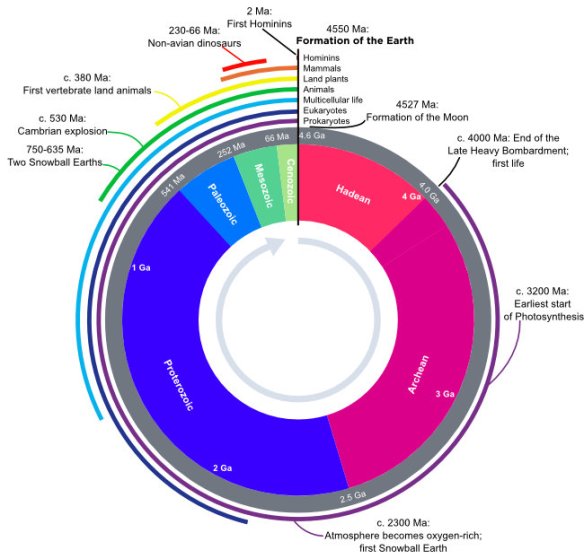
According to Wikipedia, “the Ordovician spans 41.2 million years from the end of the Cambrian Period 485.4 million years ago (Mya) to the start of the Silurian Period 443.8 Mya.” To give you a visual idea of the timescale, here is a picture of a geological clock, found on Wikipedia – humans arrived only at two seconds before noon!
The website itself can be translated via one of the translation engines on the web such as translate.google.com but I’ve not been able to translate the PDF files of the itineraries.
I had sent the itinerary to a friend who was very keen to follow it, and so one sunny day earlier this month we set off on our trip! The first stop was near Berlou, at a site which illustrates the upper Cambrian and the start of the Ordovician. On our way there, we walked past a flowering oak tree: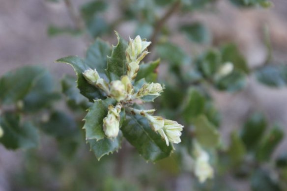
Stoechas lavender:
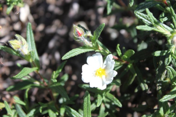
A cistus with tiny flowers:
And some wall pennywort, which the French name translates to Venus’s navel:

Unbeknown to me, my friend had done a course in geology at university in her younger years, and she’d found the hammer she used when at university!! With erosion and exposure to the elements, the surface of rocks changes quite a bit, so splitting a rock with the help of a hammer will show its ‘true’ colours. What fun we had with that hammer!!


Here are some bits of quartz, which we found at the same site.

And bands of quartz embedded in a rock.

On our way back to the car, we enjoyed looking at some very typical vegetation. The heady smell of the garrigue was wonderful!


Our next stop was on the road to Berlou, at a place where a trench had been cut into the rock for the road. The rocks on the left hand side of the cut were an outcrop of the Saint-Chinian formation, and on the right an outcrop of the La Maurerie formation was visible. I’m not sure that I saw a lot of difference, but I’m no geologist 🙂 The view of the valley in the direction of Berlou was very beautiful though!


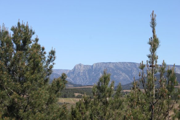
Onwards to the viewpoint, just outside Berlou, and another spectacular view of the mountain in the distance, Mont Caroux. The mountain is called ‘The Sleeping Lady’, and in the right light and with enough imagination, you might just about be able to imagine a reclining figure, with the head on the left hand side.
The road took us to the village of Berlou, and through beautiful countryside, past the villages of Escagnes and the hamlet of Mezeilles, before arriving at Vieussan. We had planned to have lunch at Le Lezard Bleu in that village, but unfortunately the restaurant had to close on that day for maintenance. We booked at table in Roquebrun instead, at Le Petit Nice. Just before we reached Roquebrun, we stopped once more – this time to observe a fold in the rock.

After a delicious lunch in Roquebrun, we continued towards the village of Saint-Nazaire-de-Ladarez. On the way there, we stopped to admire the Landeyran valley with its sheer cliffs. The cliffs are much used by rock climbers to test their skills on!

Our last stop of the day had nothing to do with the Ordovician, but was on the itinerary as a point of great geological interest, and because the road back was passing right by it! The former Coumiac quarry has been designated a Global Boundary Stratotype Section and Point (GSSP). Wikipedia defines the GSSP as follows: “A Global Boundary Stratotype Section and Point, abbreviated GSSP, is an internationally agreed upon reference point on a stratigraphic section which defines the lower boundary of a stage on the geologic time scale. The effort to define GSSPs is conducted by the International Commission on Stratigraphy, a part of the International Union of Geological Sciences. Most, but not all, GSSPs are based on paleontological changes. Hence GSSPs are usually described in terms of transitions between different faunal stages, though far more faunal stages have been described than GSSPs. The GSSP definition effort commenced in 1977. As of 2012, 64 of the 101 stages that need a GSSP have been formally defined.”
At Coumiac we are in the upper Devonian, at the transition between the Frasnian and the Fammenian. I can’t make a great deal of sense of the scientific explanation, but the rocks are spectacular to behold! The quarry is only a short walk from the car park beside the road. Two viewing platforms have been created to allow visitors safe access to the site.
 The first glimpse of the quarry is of the GSSP – a huge slab of rock, covered in thousands of fossilised goniatites (prehistoric snail-like creatures), killed during what is called the Kellwasser event.
The quarry was in operation until 1965, with a type of ‘griotte’ marble being extracted – a red marble with small inclusions of white. An example of a fireplace made of griotte marble can be found at Acanthus in Saint-Chinian.


Here is a closer view of the GSSP slab:

All in all, this was a very interesting day, and I learnt a lot!! Do let me know if I have mis-translated any of the geological jargon, I’ll be happy to correct it!

No geologist here, but the photos are lovely!
LikeLiked by 1 person
Thank you, LaVaugh – great to hear that you enjoyed the post!! 🙂
LikeLike
we know the spot… and we also appreciate Saint-Chinian wines, santé! 🙂
LikeLiked by 1 person
Santê to you too!! 🙂
LikeLike